

Table of contents of the article:
A quick introduction of Kilimanjaro
Description of the routes
Marangu Route
Machame route
Rongai route
Shyra route
Lemosho route
Northern trail - traverse route
The Umbwe route - the choice of the Kuluar
Plan of the ascent to Kili, 5895 m
The peak of Kilimanjaro attracts mountain climbers from all over the world.
In this article, we will tell you why and compare the routes to climb the highest
mountain in Africa so that everyone can choose an option for themselves.
Kilimanjaro is a stratovolcano - a conical volcano with a number of layers of hardened lava. It is located on the territory of Tanzania. The height of Kilimanjaro (more precisely, Uhuru Peak on the top of Kibo) is 5892 m above sea level. The height of Mawenzi is 5149 m, and Shira is 4005 m. The height of the volcano from the foot is over 4900 meters. It is difficult to say for sure when this peak was formed, but it is safe to say that it is more than 2 million years old. According to various ratings, the mountain is among the top ten most beautiful peaks in the world and among the three most beautiful volcanoes. Climbing Kilimanjaro is included in the Seven Summits program - climbing the highest peaks of all continents.
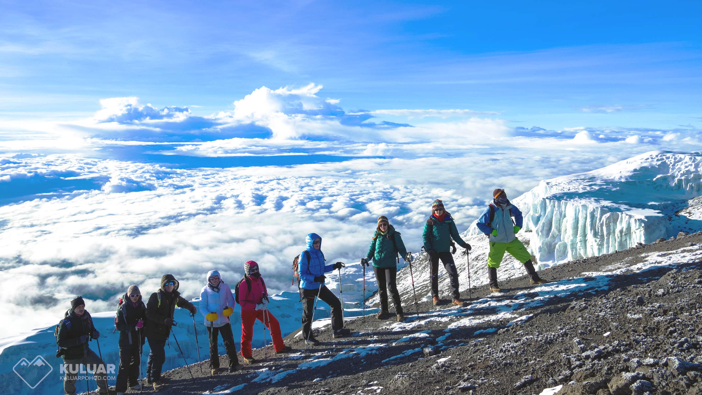
It is also worth noting that Kilimanjaro is the highest free-standing peak in the world and is home to the highest glaciers on the African continent. Unfortunately, their number is decreasing every year, but this is a reason to come here as soon as possible to see everything with your own eyes.
The origin of the name Kilimanjaro (or the Mountain of the God of Cold) is not unambiguous and researchers' opinions differ somewhat, with scientists from all over the world trying to come up with their own interesting theories.
In particular, we know that in Europe the name "Kilimanjaro" began to be used even in the 1860s. That was when the famous German traveler Ludwig Krapf wrote in his notes that the local tribes called this peak "Kilima-Njaro" and interpreted from the language of Kichagga "kilemanjaare" as "the mountain of caravans". Subsequently, in 1885, the same Ludwig Krapf studied that according to the local Swahili dialect, this name is interpreted as "majestic mountain”. A number of scholars of the time agreed only that the first part of the toponym "Kilima" in the interpretation of the local population is really interpreted as "mountain”.
From the 1880s the volcano became part of the German-influenced territories in East Africa, and the name was interpreted from Swahili into free German as "Kilima-Ndsharo”. Hans Meyer, the famous German explorer of East Africa, after the first ascent of Kibo Volcano on October 5, 1889 gave the summit a different name. It was now called Kaiser-Wilhelm-Spitze. This toponym stuck until 1964, when Tanzania gained independence and changed the name of the highest mountain to Uhuru Peak, which is translated from Swahili as "peak of freedom" and is still in use today.

Kilimanjaro consists of numerous layers of tephra, hardened lava and ash, and yet, at an altitude of 400 meters from the summit, there is molten magma. At the same time, this stone desert is covered with snow and ice. There are practically no plants or animals. The average temperature here is about -7°C, but it can drop to -15°C. The lowest temperature recorded at the top of Kilimanjaro is -27°C. It can snow at any time of the year.
| 07.12-14.12.26 |
|
$1900 | 8 | |
| 27.12-03.01.27 |
|
$1900 | 8 | |
| 05.01-12.01.27 |
|
$1900 | 4 |

At this moment there are seven Kilimanjaro ascent routes that can be used to climb Mt. Kilimanjaro and one, the eighth route, only for the descent.

Scheme of routes to the top of Uhuru peak 5895 m (brown color indicates the Northern traverse)
Marangu is one of the easiest routes on Kilimanjaro. In the jargon of local guides through its popularity it received the second name of "Coca-Cola". It is considered one of the easiest and gentlest routes for climbing, but the total kilometer from the start point to the finish line across the top is about 68 kilometers. This is the only route that is equipped with all the minimal amenities of civilization: cabins, water, and sometimes electricity. Choosing this route, you'll have an opportunity to make a day hike to the foot of Mavenzi mountain, one of the Kilimanjaro craters, but in the Horombo shelter you will need to stay for two nights.

Plan-scheme of the ascent to Kilimanjaro (5895 m) by the Marangu route
From the significant disadvantages we can distinguish only a fairly large number of kilometers to be passed each day, much less time to rest, loose ascent on the serpentine during the assault and as much as two kilometers to walk on the edge of the crater to get to the top, and the same amount to go back. A total of 6 days should be spent to reach the goal by choosing this route, and then returning down the same road. This route is quite fast, comfortable and budget-friendly, so it is very popular.

Machame is as popular as the Marangu route. Local guides still jokingly call it the "Whiskey Route". Today it is one of the most beautiful routes to the summit of Kili. It is more difficult from the first option - Marangu - but at the same time more logical and convenient.

Map of the ascent of Mount Kilimanjaro (5,895 m) on the Machame route
The Machame start begins among the dense slums of the rainforest on the southern slope of Mount Kilimanjaro. In the second part it merges with the other two branches of the route: Lemosho and Umbwe at Baranko Camp. In this way, the configuration of the trek allows you to view the main summit from a slightly larger angle. A total of 7 days should be set aside for the entire journey for this route. Potentially it is possible to overcome it for six days, but for performance of such a task all participants of the group will need good physical preparation, experience of staying at such altitude, understanding of behavior of the organism in conditions of oxygen starvation and the previously acquired acclimatization.
The variant of the program with seven days can be optimal for an average tourist.

Rongai is the only route to the "roof of Africa" on the northern slope of the mountain near the Kenyan Frontier. The ascent originates from the town of Loitokitok, hence the second name of this route. Due to the considerable distance from the main tourist cities of Arusha and Moshi, the logistics and access directly to the route are more complicated and require a significantly longer time commitment. Such prerequisites became a factor of low presence of mountaineers and rather small concentration of tourist groups. You may therefore choose this climbing option for those who like solitude and want to be alone with nature and fully enjoy it.
You may be interested in the weather conditions and microclimatic conditions of the northern slopes, where there is the least amount of precipitation and less gusty winds. It is worth preferring this option for climbing especially during the rainy season. This route will not be as contrasting as the options from the south, but it passes through a nature reserve, and during the acclimatization walks there will be an opportunity to get closer to the Mawenzi volcano and the lake of the same name. At the lower part of the trek, you'll see pine forests and plenty of monkeys - colobus monkeys with luxuriant, lush tails.
The transitions between camps are characterized as relatively short and gentle. To reach the main summit, you should put 6 days in the program - for more experienced hikers, and 7 days - for beginners and amateurs to feel comfortable and safe at altitude. Rongai is used only for climbing up. On the fourth day the Rongai route merges with the Marangu route at Kibo Hut. The descent is either to the Mweka exit or Marangu.

The Shira route is one of the two western routes, in fact, correlates and largely repeats the Lemosho route. Before the start of the trekking part all mountaineers are driven up to the altitude of 3400 meters. This has a negative effect on well-being, because already at the start of the route all the group members may have all the signs of altitude sickness. In general, this option of climbing may be characterized as very long and slow and it will require seven days to reach the top of the mountain. However, in terms of its colorfulness, beauty and pristine landscapes, Shira route is not inferior to Machama. This route to the summit will be optimal for true nature lovers to be able to experience the untouched corners of the wilderness unspoiled by man. From Shira Cave Camp, the Shira Trail will merge with the second West Lemosho Trail, so there will be noticeably more people on the trail. Descend down the mountain is carried out on the route Mweka.
Once again we would like to draw your attention to the fact that the Shira route is chosen only by trained climbers who have experience in climbing considerable heights within a short period of time and quickly adapt to extreme or stressful situations for the body.

The second western route to the summit of Kilimanjaro is Lemosho. It is recognized as one of the longest routes for climbing, with a length from start to finish of more than 70 km. This is a favorite route of the famous American climber Scott Fisher, and he has been to the summit of Everest more than once.
During the ascent we will need to try hard to meet people on the way, because the route is the most expensive in comparison with all the others, actually because of its length. So you certainly will not be bothered by the presence of other people around you, at least in the first part before merging with the other routes. To pass Lemosho should be laid at least eight days, but some amateurs stretch it to ten days. The terrain is fairly gentle, and the first overnight stay at a modest altitude of 2,650 meters. Such prerequisites contribute to a fairly good acclimatization of the group participants throughout the trekking part. On Lemosho there will be an opportunity to see colobus monkeys and some of the most beautiful panoramas of the Shira Plateau. There is a memorial plaque to climber Scott Fisher at Shira Plateau Camp, and the remains of elephant bones also lie there. This testifies to the fact that these animals once reached here. In its second part, this route combines with the Machame routes and, from Baranko Camp, with the Umbwe. Descend down the mountain to Mweka Gate via Millennium Camp.

In the category of the longest route, the Northern Traverse is firmly in first place. It is a new route to the summit of Kilimanjaro. It starts from the Londorossi Gate and for the first two days follows the same route as Lemosho. On the Shira Plateau, from Lava Tower, the trail turns north and runs along a longer route, the northern cirque of the crater. While all other trails are laid out south of the mountain by the Baranko Valley. The route should take at least 10 days to complete.
The northern traverse is ideal for professional photographers, as the nature here is in good preserved condition and the summit itself will each time open up in a new - even more interesting - perspective.

Let’s start the examination of the route, which is considered the most difficult of all known for nowadays. In a number of informational descriptions on different sources the route of Umbwe is positioned as dangerous and quite difficult. However, the route is now modified from the original and on the third day merges with the others. In terms of length and position relative to the summit, Umbwe is the most direct and shortest route. The guides there call it "Double Whiskey" in local lingo. The description and review of this route will be more detailed, as it is the main route used for our climbs.

First, it is the shortest route to success, and second, it is the least crowded. Weighty factors in choosing this particular option were also the short and quick transitions between camps, which ultimately allows all of us to have plenty of free time to sleep and rest, since we arrive at all the assault camps at lunchtime. Lovers of taking beautiful pictures will have a reserve day for their favorite thing to do. While on other routes groups of people gather in long lines, we spend the first two days alone with nature in complete solitude admiring picturesque views and various mysterious sounds, which constantly come from behind the tree branches of the dense jungle. Oh, yes, we almost forgot to say, it really is one of the leaders among all the trails in terms of the contrast of nature and its beauty. In addition to all of the above, the advantage of Umbwe is that the ascent is one way, and the descent is quite another, which gives you the opportunity to see two routes in one program.
We invite you to watch our video report on the Kilimanjaro climb:
The ride to the beginning of the trekking part is very convenient and time-saving. It starts from the Umbwe Gate at 1,660 meters. This all makes it well before lunch time to start the ascent of the first day of the program to Umbwe Cave Camp. This part of the jungle is also home to many different monkeys, so it’s easy to see them.
Many native plants endemic to Kilimanjaro National Nature Park grow along the entire Umbwe Trail. And on the second day there will be an opportunity to photograph plants that are very similar to the large cacti, senecio and lobelia, which are found exclusively on Kilimanjaro. The free time of the second half of the day can be used just to find and explore a whole range of rich flora on the slope of this part of the mountain.

Diagram for the ascent to Mt. Kilimanjaro (5,895 m) along the Umbwe route
On the third day, the Umbwe route merges with the others and from Baranko Camp to Karanga Camp will take us over the "wall for breakfast," but don't worry if you've never done any climbing. There has long been a good wide climbing path, which is flexible coming through all the difficult areas and small "steps" lead us upwards. By the way, the most colorful photos turn out on this part of the route. And from Baranko Pass you can admire the magnificent view of another volcano - Meru, here it opens in all its beauty from one side, and Uhuru Peak from another. The terrain is beautiful. On the approach to Karanga, the volcanic landscape turns bright red, and the flamboyance of the rocks and their morphology remind us of the volcanic landscapes of "little Iceland."

Plan-scheme of the ascent to Mount Kilimanjaro (5895 m) by the Umbwe route
The trek to the High camp is quite fast and short, besides it is constantly accompanied by an unbelievable view of the southeastern ridge of Mount Kilimanjaro. Between the rocks you can often spot the funny little gray mountain mice that like to forage for food with the hikers. There is usually enough time for all groups to make an acclimatization trek to Kosovo Camp and return to Barafu by lunch, spending the entire afternoon to rest and sleep before the main ascent.
The ascent to the summit from High Camp begins at midnight. A very slow pace, which is chosen by the local summit porters who accompany you. And so that at night during the climb you won't feel very sleepy - the guides will sing local rhythmic songs loudly and cheerfully, it will keep your attention.

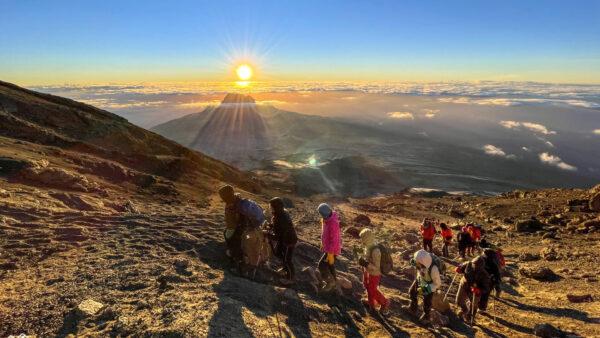
We will be at the summit at sunrise, the best time when visibility will be conducive to seeing all the views around: the horizon, the crater, the glaciers, and so on...
The descent will be to Mweka Camp. The main feature of the Mweka trail is that the landscape and vegetation is very different from all previous days. Here large protea flowers, another rare endemic of the slopes of Mount Kilimanjaro, grow on tall bushes.
The morning of the last day at Mweka camp will start with loud cheerful dancing and singing of your porters and guides as they congratulate you on your successful ascent of Uhuru Peak, the highest peak in Africa!
In the practice of climbing stand out another, ninth, route - Lava Tower. We will not dwell on its description and characteristics, because officially this route is closed, and to climb Kilimanjaro by this route is impossible nowadays because of melting of the glaciers, frequent rockfalls and avalanches!

We strongly recommend taking your ascent of Mount Kilimanjaro very responsibly! Our teamleaders and local guides will ensure the highest level of safety and comfort during the ascent. However, you should not forget that the altitude of the mountain is very high and can greatly affect the well-being and health of the unprepared tourist.
We wish you pleasant climbs and reach your summit!

Kuluar – your life changing mountain experience!
Author of the article:Andriy Pylypiuk