
To the northeast of Sogne Fjord, the largest fjord in all of Europe, is a place that has long beckoned travelers with glaciers and a perpetually snowy peak. The ancient landmark near which the path between Sognefjord and the city of kings once ran is Gudbrannsdalen. And finally, the mountain, which is the highest point of all Scandinavia. The name of this mountain is Gallhöpiggen.
Galdhøpiggen – literally translated from Norwegian means “The peak of Mount Galdhø”. The “Gald” part of the name means “steep mountain road” and the “hø” part means “large and rounded mountain”.
The most popular climbing routes:
Let’s look at both climbing options in more detail.
It takes more than 5 hours to get from Oslo station to Spiterstulen, which is 352 kilometers long, with two transfers: Otta skysstasjon and Fossbergom (Lom). Then you have to take a cab southwards for another 32 kilometers to Spiterstulen.
In your own car it will take a little less time to get there. At the fork called Røysheim you have to turn left. For the last part of the road (Røysheim – Spiterstulen) 17 kilometers you will have to pay about 100 kronor.
The road is similar to the above, only at the Røysheim fork you go straight to the Galdesand fork. After turning left, you have to pay 100 kroner for the next 14 kilometers until you reach Lake Juvatnet.
Another, more interesting way to the village of Spiterstulen is as part of a hike through Jutunheimen National Park. It takes 3-4 days to hike from the village of Giendesheim, but believe me: what you see along the way is definitely worth the time!
From the tourist center Spiterstulen have to climb a total of 12 kilometers with a set / reset elevation of 1300 meters.
Those who have at least once been on the relief of the Carpathian Gorgan will have a slight advantage during the ascent: the relief of the crystalline rock gabbro is very similar to the shape of the Ukrainian Gorgan.
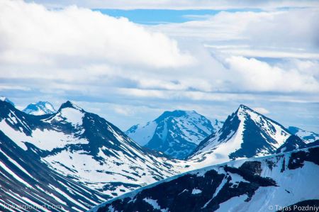
As you climb, of course, there will be snow. You don’t have to worry about it: during the summer, the sun worked hard on the east side of the slope, so the snow cover will be shallow.
Closer to the top, black dots will appear on the right, at an equal distance from each other. These are tourists in bundles who are climbing the glacier from the side of Lake Juvvatnet. The time of the mass ascent with the guides begins at 10 am.
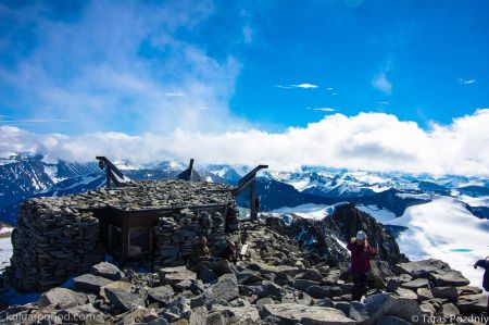
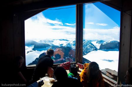
Finally, the top of Gallhöpiggen appears. The surrounding scenery takes your breath away. But the same effect can also come from the cold wind with wet fog. In this case, at the very top there is a shelter-cafe where you can warm up with tea, have a snack, buy souvenirs and leave your name in the climbers’ journal.
The way back will be faster and more interesting as on the snowy slopes you can make a few dozens of meters downhill with giddy shouts. Just be careful.
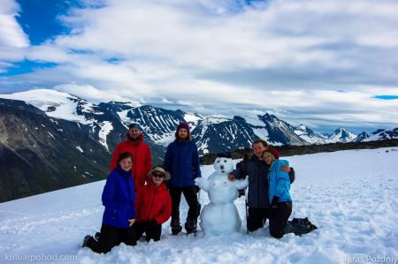
From the Juvasshytta hiking center near Lake Juvvatnet the climb is easier: 700 meters of ascent/descent and 2.5 hours of walking. There are even groups of schoolchildren on this route.
The gentle glacier that appears halfway to the summit poses some danger in the form of cracks. This is why the Norwegians strongly recommend hiking this part of the route in bundles, and a sign on the sign that reads “Danger!” eloquently warns about it:
On the way back you might meet the regulars of the mountains and tourists’ favorites – deer. Also near Lake Juvvatnet you can visit the museum Klimapark 2469, an artificially dug tunnel in the glacier. Judging by the descriptions of tourists, it is not inferior to a similar museum in the glacier below the peak Matterhorn, located on the border of Italy and Switzerland.
Which of the two routes is better – you choose. Either way, the path to the summit will be a sporting experience and you will remember the breathtaking scenery of the surrounding Norwegian mountains for a long time.